Drains McMechen respectively, including Mosher and John. Was relieved by Druid Hill/ North Avenue Intercepter. It varies in size from an arched culvert 12 feet wide and 15 feet high to a circle 4 feet 6 inches in diameter. Drains out the Rutters Run Lateral. An old, forgotten, buried yet ever present stream. Extensive system with 2 significant junction chambers. Its tunnel system drains out an area known to be notorious for small streams,springs and quicksand. The same engineering grief was had during the construction of the B&O railroad tunnel that lies just north of this tunnel. Exploration of these tunnels requires a man raft as it is block by a deep pit of water of unknown depth. It was once thought that a man raft would be required to access this system but later explorations proved otherwise. However, it has come to our understanding that old drains suffer from deep silt deposits and stagnant air making their penetration and documentation quite treacherous.
Exploration & Discovery Abstract
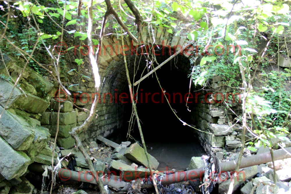
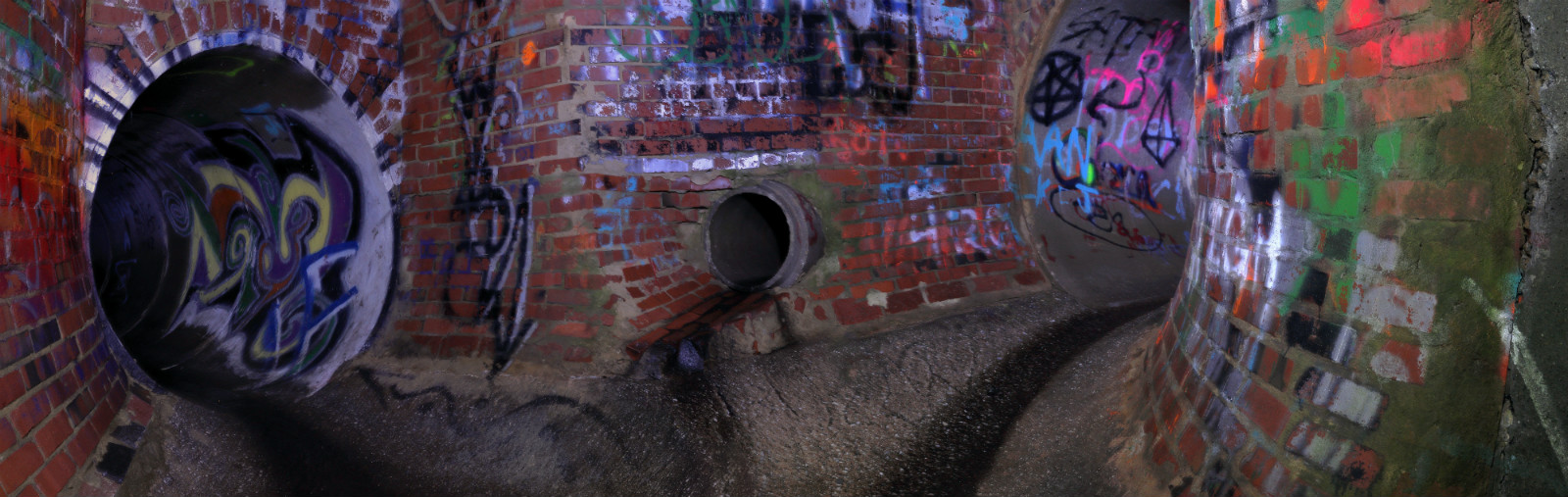
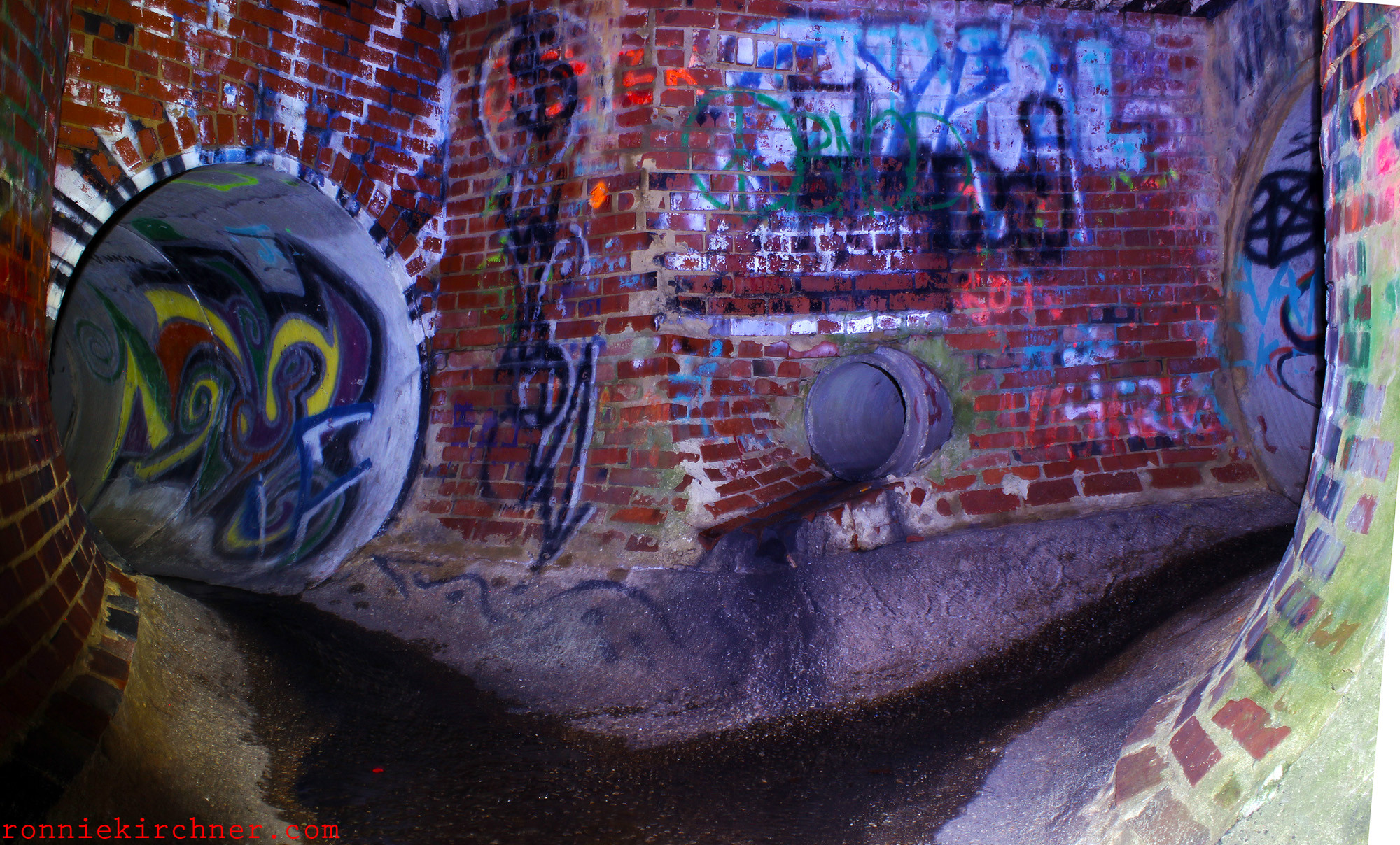
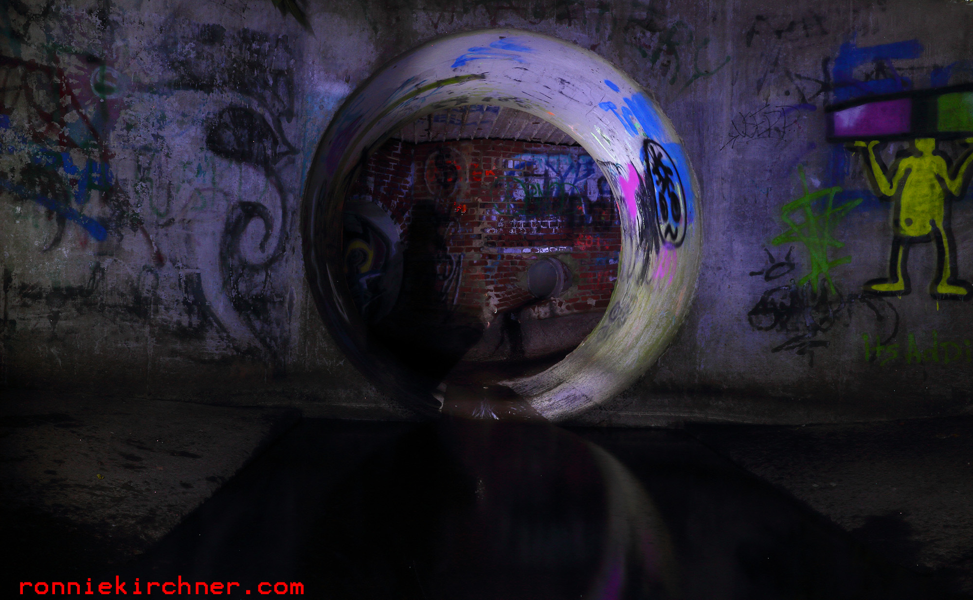
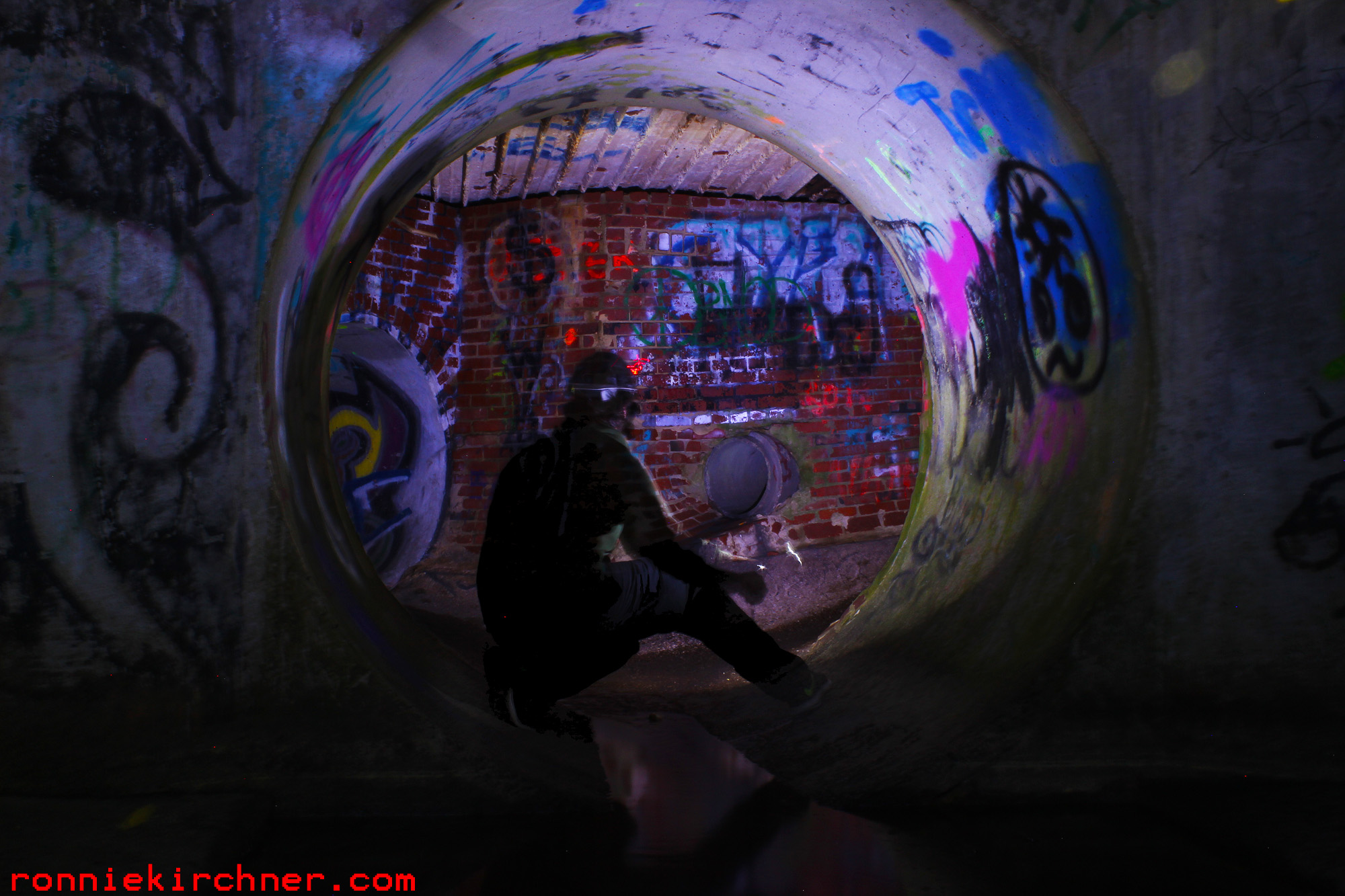
This tunnel lies within the zone of Baltimore’s “Forgotten Triangle”. For years this tunnel was missed, as it is tucked away in thick brush and mangled railroad waste and appears irrelevant to the untrained eye on satellite imagery. However, one day, the explorer took note of a small, slow flowing stream (almost stagnant in some places) that was tucked away in the corner of the Forgotten triangle. It was decided to follow this stream, with little hopes that it would turn up anything more then a small stone storm drain. The terrain leading up to the drain is treacherous. Mangled, metal and trash strewn everywhere making the explorer cognizant of every step he takes. There is evidence of old foundations and structures and a reconstructed railroad utility. bridge After about a 10 minute traverse, you don’t see the tunnel until your right on top of it due to tree branches and snake like vines covering its entrance. At this point, its like your down in a hole. The side embankments are about 15-20ft above your head but the stone granite arch tunnel itself is like bored into a 40 foot high embankment.
West side Storm Sewer Interceptor
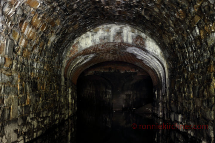
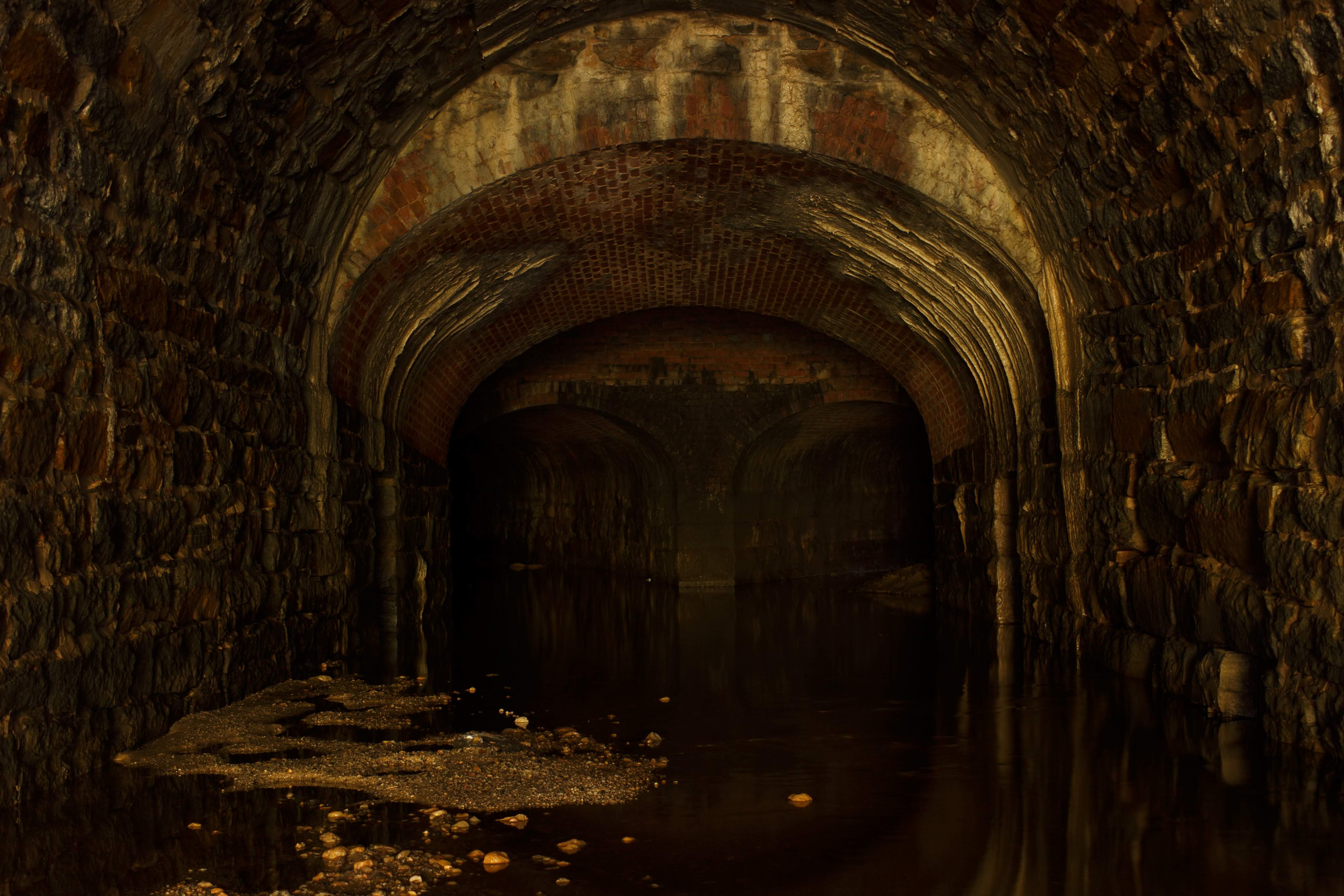
Large interceptor storm sewer drain system built to drain out an area that was known to have many small streams and springs. A 2 fold problem existed, the old Druid Hill Avenue storm sewer was of insufficient capacity and the old McMechen Street Drain was already at over capacity. 2.1 meter (7 ft) oval , Brick Arched Culvert, with a masonry granite floor laid in American hydraulic cement 14 inches thick. This drains drops significantly in elevation along its course to outfall and accomplishes this via multiple vertical drop shafts or vertical drop wells (4 total).
Adventure/ Urban Exploration Video shot soley on a GoPro Hero+ and Canon T3i in this exact drain found below.
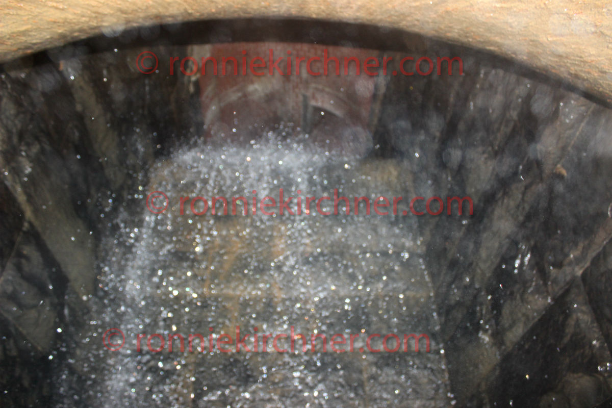
Vertical Drop Shafts featuring shafts constructed out of granite masonry that was laid 8ft x8 ft deep square outer diameter (OD), with final sizing 4ft x 4ft internal diameter (ID). The original iron cradles sit at the bottom of these shafts to smoothly drop the water from elevation to the floor. These iron cradles have proven to a very robust and enduring construction method. 1 significant junction chamber. Extensive small laterals. 1.5 percent grade. In connection with the above were constructed the outfall of the sewer of heavy rubble broken range masonry at the west side of Jones Falls with its wing walls parapet and timber apron the four vertical drops eight feet square with cast iron inverts and the sides and ends faced with heavy dimension stone with depths of eighteen six and one half four and one half and five feet respectively the first two being excavated in hard and rotten rock requiring blasting On the line of the main tunnel four shafts were constructed to depths of 27ft, 43ft, 41ft, and 28ft feet respectively for the purpose of hoisting and lowering materials for the construction of the sewer Of the above there was completed during the year 1895.(ref a.)
Apparently this old storm sewer got in the way during the construction of a section of the B&P tunnel. Later they ended up utilizing it for the drainage of the train tunnel. Reference below.
Another unscheduled problem was encountered in the John Street Tunnel where a storm sewer crossed under the invert after following its centerline for about 200 ft. Originally an old brick-lined barrel and arch, its top had been partly uncovered, probably during invert work in 1916-1917, and slabbed over. Because this structure was at a higher elevation than indicated on the plans, it was severely damaged during invert scarification. (ref b.)
It should be noted that this particular drain had an incident of surging during its first exploratory documentation. The reason to this day is unknown. No precipitation was recorded that day in the area served by this storm sewer let alone watershed. Documentation exist that a section of the John Street tunnel, that passes near by requires water pumps to pump out a low lying area inside the tunnel. It specifically states that the water is pumped into a nearby storm sewer. It can only be assumed that it does so in intervals, such as like a sump pump behaves, which in turn would explain the sudden surge of water. Referenced to this coming soon. here: The sumps were located under the tracks at the south portal to cut off the entrance of outside water supplementing the original pumping chamber, and in the Wilson Street Tunnel just short of the rock line of the intersection with the tunnel invert. Water from the sumps is pumped to the city storm sewers. (ref b.)
REFERENCE
a.) Annual Report of the City Commissioner to the Mayor of Baltimore 1889
b.) Rehabilitation of Amtrak Baltimore and Potomac Railroad Tunnel in Baltimore, Maryland. Pg 31-33, June 1981
This tunnel system was yet again discovered through research of historic maps. Gwynn’s run was a significant branch that emptied into the Gwynn Falls River. After the discovery of the M.J.MM Storm Sewer Outfall the writer began focusing more research on the West Side of Baltimore. The Gwynn’s Run branch is clearly seen in early historical maps. When researching old sewer and storm sewer maps, a large number of existing drains and planned construction drains were seen to dump into this open air branch. The branch does not appear on modern day maps and stop appearing in the early 1900’s. Where did all this volume go? There was only one way to find out and that was to go out and explore the area. To uncover what Google Satellite view and Bing Birds Eye view did not reveal.
Accessing the lower portion of this tunnel system initiatlly had its hurdles and considerations. Your in the heart of the Murda-land, Bmore Bodymore. So there is always the concern that you will come back from an explore and find your vehicle’s windows bashed out and on blocks. Then you have to figure out how to get there by not crossing private property. An urban patch of woods, that was visualized from satellite view and now im enveloped inside. Unknown territory, senses on high, living the summer explorers dream. Topographical sense kicking in now, a few animal/bum trails one could follow, many that lead too thorn bushes and poison ivy patches. Following the trail that drops in grade proved successful, and by this time that distinctive sound of water colliding with rocks can be heard but not seen through the thick overgrowth.
Proceeding forward by ducking through natural holes found in poison ivy patches, still unsure if this time spent will pay a dividend. A large creek suddenly becomes visible. By the time you reach a broken concrete embankment the smell of sewer fresh is strong and you realize that your trouble was well worth this reward.
A massive 6 meter high granite arch that has held up since 1829 towers over you with a very distinct keystone at the center top. The retaining wall soars even higher then this. The area around this outfall is like a waste land. Trash and debris like mangled metal, pieces of furniture, tires, car parts, railroad waste strewn everywhere covering the rocks. Debris stuck in the branches of the surrounding trees, this place must rip during storm surges. A flood stage gauge sits in at the tunnel entrance. The drains potential capacity is hinted at by the gauge rising nearly to the half way point of this outfall.
There is a convenient little 12 inch ledge that follows the base of the tunnel and takes a right angle into it. When you peer around the corner, air is just blasting out of there. Pushing further in about 10 meters, you quickly realize that this ledge drops off out of site into deep murky, cloudy water. Only God knows what lies at the bottom and its most likely quite deep after a 175+ years of storms ripping and eroding a trench through there. (It was first thought) that further explorations will require a man raft or something to float you in there The main outfall seems to continue about 50-70 meters or so and takes a sharp easterly bend. Its interesting that large boulders seems to be built or left in place at this bend. Which makes sense as its a sharp artificial turn in the river and those boulders must receive a brunt of the water pressure and friction as the creek obeys the tunnels command.
In my writings, I seldom mention that I’ve really come to learn that water can produce strange acoustics in underground confined spaces. Sometimes its almost like the chattering of a crowd of people at times. I will highlight that the sound coming from inside this tunnel that bent out of sight was quite eerie to say the least. Its hard to describe, its almost like you could hear a group of men working back in there.
A crude attempt to estimate a typical summer storm surge discharge volume: When comparing the data of 3 USGS monitoring sites The rough calculation was done by taking the measured stream discharge volume, at the Villa Nova stream gauge which sits upstream and then adding the measured discharge volume of Dead Run, a tributary that dumps into the Gwynn Falls River proper. Subtracting the sum of the 2 measured discharge poitns, by the total measured discharge of the Gwynns Falls River discharge gauge at Washington BLVD with the difference being associated with buried portion of the Gwynn Falls Run system. The rough numbers seem to suggest that the Gwynn Falls Run Storm Sewer accounts for 20% of the over all final discharge of the Gwynn Falls River during periods of storm. The rough data seems to show that the drain would output 250-300 cubic foot a second during a typical 0.4″ of rainfall summer storm. More treacherous guesstimates were performed, trying to conclude the theoretical capacity of a arched culvert that is 5.7 meters wide and 6.1 meters high at the top of the arch. Not knowing the formulas for calculating the capacity of an arch, the length of this section and variables such as slope it wouldn’t be surprising if 1000+ cubic foot a second could discharge via the outfall.
| Jenkins Run Storm Sewer Tunnel | Jenkins Run Stream | Guilford Avenue / Jones Falls Conduit Construction Tunnel|
Jenkins Run Stream is an ancient stream drains into the Jones Falls River Basin. It still exist today but pretty much has been forgotten due to it being covered over and buried in an underground culvert or tunnel. The original upper portions were constructed in the late 1870’s . Its construction spanned over a period of 30 years related to general mismanagement, lack of funds, numerous pitfalls and delays. Like many storm water drains buried in Baltimore, difficulty arouse from the varying geological conditions and numerous springs encountered. The torrential nature of this stream during periods of extreme downfall would succumb to violent flooding. Compounding these complications included poor workman ship of its contractors. Which, on a few occasions required the reworking of the drains foundation at one point. A a remarkable interceptor, with a robust history that is not even touched in this writing.
The Jenkins Run Storm sewer, intercepts and drains a moderate portion of the North Eastern drainage basin of Baltimore City. Most notably the Carter Alley stream (which had already been buried for some time) was junctioned into the tunnel via the Old Carter Alley Sewer. The At one point it crosses under the Union Railroad tunnel and in turn serves as a drainage point via a 33cm (13 inch) cast iron pipe(ref.). Its tunnel network traverses through a portion of Greenmount Cemetery. At one point the tunnel even crosses near a section of old graves. It is quite well preserved and shows little signs of wear. Tunnel sections vary significantly throughout including: height, width, design and material composition.
The “newer” lower interceptor tunnel was finished in 1912, with the completion of the JF conduits and the Guildford Avenue Diversion tunnel. Chief Engineer Calvin Hendrickson awarded the work contract to the “Fisher Brother Company”. Hendrickson reported to the Baltimore Sun during a walk through tour that this final portion of the tunnel was bored through solid rock to the size of 365cm (12ft). At its deepest point the tunnel lies 16 meters deep (52 feet). Its construction team were described as looking like “miners”. The most modern 20th century methods were used to in its boring . Costly modern machinery that ran off compressed air were used and the workers had the luxury of electrical power to light their work area. Power being provided by a generation plant off Preston street. (ref.c)
It should be noted that before its completion, the lower portion of the Jenkins Run Interceptor drain was used as a haulage construction tunnel. Materials were hauled in and out of the tunnel. Much of the excavated rock was processed and used in the concrete mixtures in the tunnels found downstream. At its completion, the loathsome CSO / SSO #72 was placed. It boasts a significant steep grades, staircase / drop falls, full brick tunnels, brick arch horseshoe tunnels, masonry granite, overhead flume, long curves, numerous stone granite side drains and a CSO/SSO purge discharge point. In the upper mid section of the tunnel, houses a sizable double junction chamber. The western tunnel is old granite stone construction drain, that doesn’t work well. Standing water and old air back in there . The eastern shaft is the continuation of Jenkins Run. Basically, the further you go back, the older is gets. And the Jenkins Side goes back deep, well above North Ave and with its limited surface access presents the most fearsome environment in an already dangerous city.
Jenkins’s Outfall
Historical Quotations:
“The Jenkins Run Drain empties into the Jones Falls between Preston and Hoffman streets runs northerly via Carter alley to a point 135 feet north of Lafayette avenue and thence northeasterly to a point in Boone street north of Twentieth street For 3,270 feet to a point in Walcott street it has cross sections of from 163 to 49 square feet and is built with a segmental arch Above this it is circular and 10 feet 6 inches in diameter It drains nearly 900 acres including Homestead and that part of Waverly east of the York Road It has two principal branches
In Hoffman street to Home wood avenue 4 feet in diameter
In Girard avenue to Barclay street 3 feet in diameter .”
(ref. 1)
“The heading of the tunnel under Guilford avenue has been extended from the entrance of the retaining wall between Biddle and Chase streets to a point 250 feet beyond Preston street a total distance of 8oo feet The heading of the Jenkins Run Sewer tunnel has been extended through to meet the large tunnel a distance of 430 feet The rock excavated from this tunnel is being crushed and used to form the concrete conduits in the bed of the Falls below Chase street.”
(ref. 2)
TUNNEL EXPLORATION NOTES:
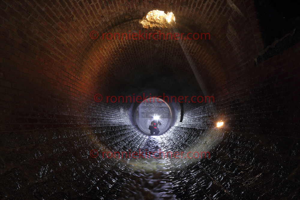
Exploring a massive 12 foot drain, from within another massive drain requires knowledge, planning, physical fitness and wit. Such a treacherous adventure should not be carried out by a casual urban explorer, the ill prepared or weak hands. When this drain was discovered, research seemed to point that this tunnel was draining what was once known as “Jenkins Run”. An ancient stream that was buried & covered over well over a century ago and is the largest buried stream outfall in the Jones Falls Conduit system. Every time this tunnel was passed, a strong curiosity beckoned for its penetration. What lies inside was an unknown, granted its overall large size, one could only assume it was the beginning of a large storm sewer network. If subsequent research was on point, it seemed that sizable chambers may lay within. Years later, infiltration was undertaken and the curiosity laced with patience & preparation paid off. A strong wind pours out of this tunnel, however, it was decided that subsequent exploration would require a Multi-Gas Detector.
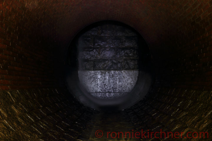
The Buried Outfalls Entrance into the system The tunnel briefly bears right before straitening out, most likely for hydrological considerations as it meets the underground Jones Falls river Jenkins run and Carter Alley Junction Chamber Looking up the stairway towards the later portion of it.
The original Jenkins Run diversion chamber photo source (ref .2)
A quick video glimpse of Jenkins Run Outfall
references:
a)Report of the Sewerage commission of the city of Baltimore , 1897
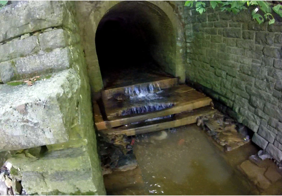
The Princess Drain featuring a brick laden flume chamber. So low key and easy to access, with curbside parking and a 3 meter hike. Even a princess wearing high heels, while taking a selfie could access. Hence the name Princess Drain. It even has slots built into the walls, to place your lamps for exposure shots.It is a sizable storm drain, draining an urban shopping zone with its showcase double flume chamber feature, no further then 8ft inside. Keep reading more below….
This drain was accidentally found on google maps while searching for directions to a newly relocated supermarket. A small stream appeared out of nowhere, from underneath a parking lot, emptying out into a park/wooded area. Any urban explorer or drainer would be highly suspicious potential drain and at the time, the GPS was simply highlighted and saved/bookmarked on Google maps and left be.
Months later, an hour of free time came about after a 13 hour banger at work and I already was in the vicinity and spontaneously decided to explore and confirm its existence. The last time I spontaneously did some urban exploration was over a year so I was itching to get out and get some more fresh content. Ironically it began to drizzle, as soon after I pulled into the parking lot. Shaking my head, speaking into the rolling GoPro “When it Rains, Stay Out of Drains”. I am already here, Im just going to check it out and confirm the existence of something worthwhile. While pulling into the parking lot, it became very apparent that access to this drain would be extremely easy. Already I would see the line of trees, hiding the urban stream dead ending into the parking lot.
I literally park next to a short foot path leading into the park or veer left down into the drainage basin. Boom there it was, a sizable 6ft drain with corresponding slanted concrete walls, laid out into its foundation. Princess Drains most notable and worthwhile features is not more then 2-3 meters inside. Two 130cm concrete drains join into the one 2 meter drain. This was accomplished by constructing a brick laden flume chamber.
The one left sided drain does not go back very far, as a brick wall can barely be seen standing at its mouth. The second right sided drain, leads out toward the direction of the road and was later penetrated. Curiosity left ungoverned, one could hypothesize “What if it connects into the old system, what if this pipe served as an overflow (CSO)?”. Later exploration & penetration of this section proved that, following this tunnel, all the way out to the road, the tunnel simple continues after a corner. The corner consisted of a nice brick laden section before continuing onward, following the direction of the street.