
Features: Infall/Intake Tunnel, Semi-Elliptical, Vitrified Brick flooring, Buried Culvert.
Build Dates: 1913 , 1928
Length: Approxmiately 3200meters (2 miles)
Upper Gwynns Run Pecks Branch outfalls into the Gwynns Falls north of Lower Gwynns outfall location . At its mouth, it is fed by a wash water lake which in turn is fed by a small network of streams. Its seems that the multiple stream feeding into the northern parts of Gwynns Run are referred to as Pecks Branch. “Overflow from the wash water lake is controlled by a drop inlet spillway that sits at the southern end. The spillway discharges into a 297cm (9.75′) x 305cm (10′) semi-elliptical drain. The drain discharges directly into Gwynns Run.“(ref 1, 1980) Shortly there after the stream disappears underground via an infall tunnel.
If the research is correct, The Baltimore Bureau of Sewers would be responsible for its construction of this upper network. Fueling off of Chief Engineer Calvin Hendrickson’s philosphy of “not carrying storm water for longer distances then neccessary”. It seems that the Baltimore Health Department started pushing for the burial of this stream. Citing health concerns related to its “Vile nature”. Finally in 1925, a report was published by the Baltimore Health Deparment board of medical practitioners, (most likely consisting of members of the prestigious and powerful Johns Hopkins entity) . The report advised that Gwynn’s Run be buried and diverted into an underground tunnel(ref 2, 1925).Three years later, the upper tunnel construction was complete and Gwynns Run’s proverbial death certificate was signed and stamped in 1928.
Timeline of Events?
Historical research is still ongoing regarding the time periods and sequence of burial events. When comparing historical literature with GIS data it appears that different tunnel sections were buried at different times. It is clear that a granite culvert was perserved and transitioned into part of the tunnel. While the GIS data supports the far north upper tunnels being built in 1928, the southern end sections show build completion dates in 1913.
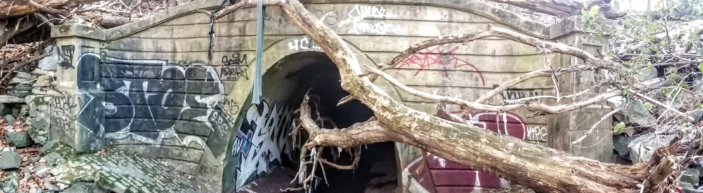
Infall Tunnel:
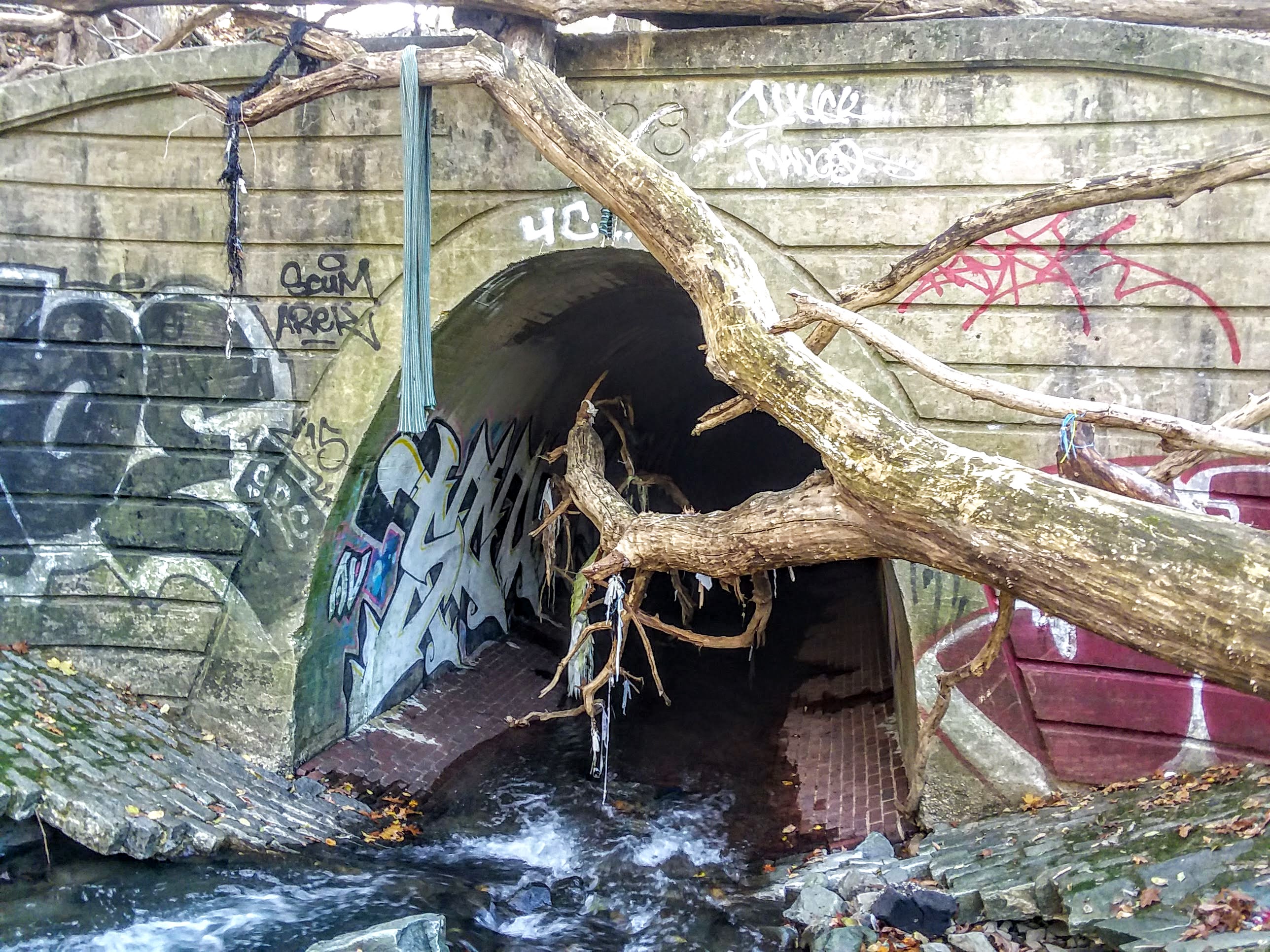
The date 1928 is displayed on the top center of a beautifully, uniquely crafted head section (of its infall). A remark must be made regarding the head section of the infall. It is obvious that much attention was given its aesthetics. Perhaps due to its vicinity to a residential area and park? Regardless, its a work of beauty, masonary craftsmanship, product of the roaring twenties before everything crashed. Its sides are guarded by square column like posts which wrap and transition to the face of the head. A lipped ledge sits on top of the head and below it, evenly spaced parallel indented lines travel across its face, until they meet the tunnels apparent frame.
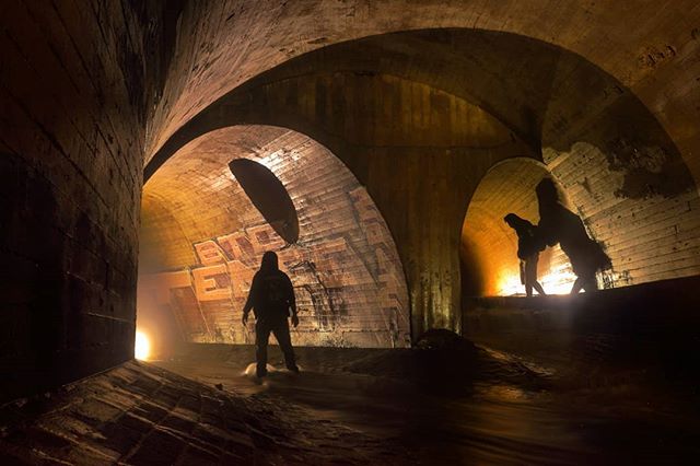
Trunk Tunnel
Build ultizling cut and cover methods of tunnel building. A semi-elliptical shape is noted through the majority of this trunk. At the its ceiling’s peak, towers 4.5 meters in height. Its concave brick laid floor spans at least 3.5 meters. Its walls and ceiling are appear to be composed of reinforced concrete. The course of the tunnel shows the radical nature of the topography that tunnel builders had to cope with. The tunnel winds and turns as it follows perhaps an original stream valley and significant drops in elevation are noted. Numerous series of small drop wells (8″-12″ in height, 1-4ft in length) found along the way.
A small stream junctions with the main stream. Flowing from another semi-elliptical tunnel that sits higher and is approximately 2.2 meters in height. Seen in below picture.
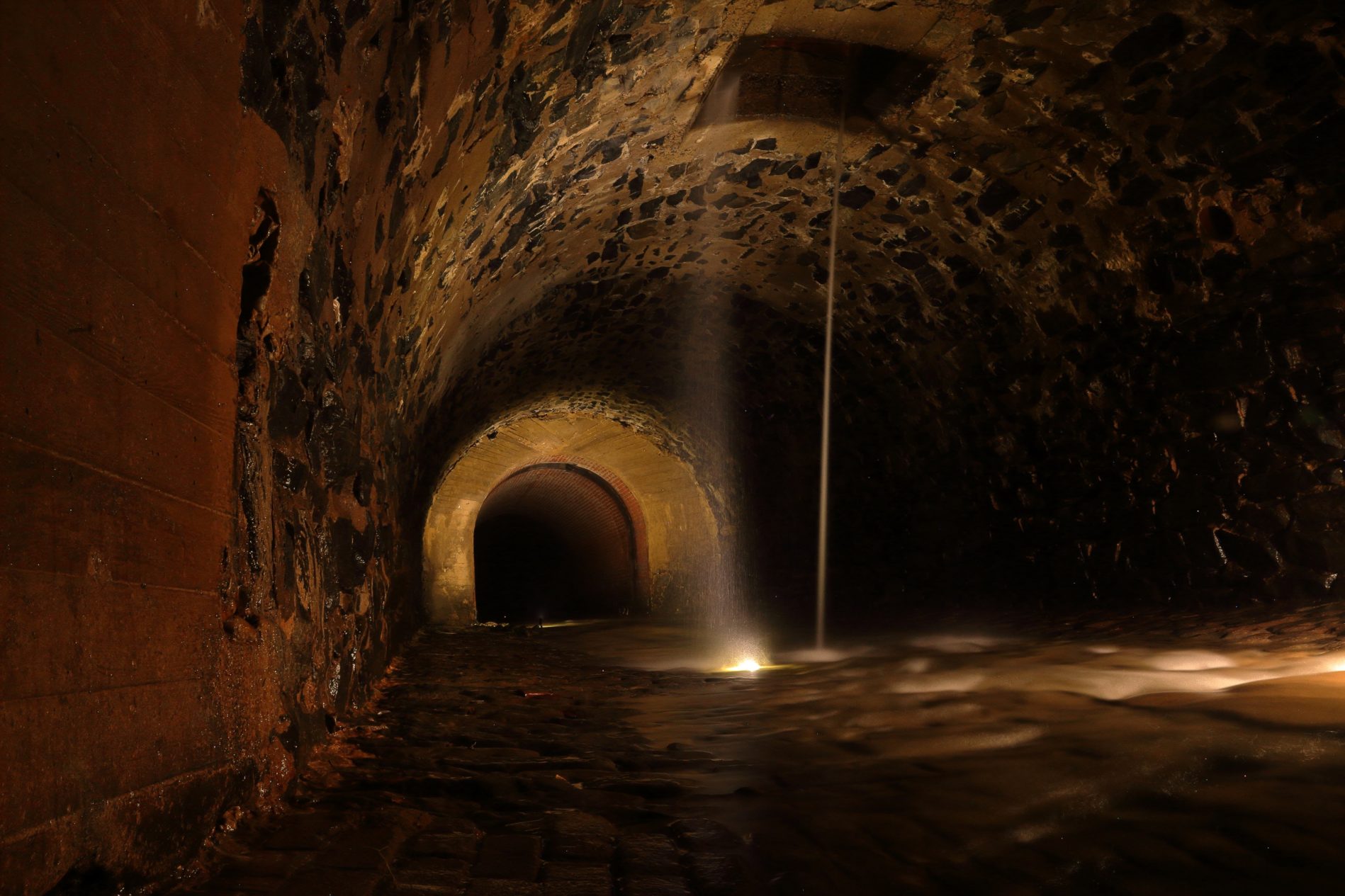
Much further inside another structure of great interest presents itself. The tunnel widens and transitions from concrete walls / brick floor to stone granite floor, walls and ceiling. Much like the stone granite walls we see built in Baltimore’s pre 1900’s storm drains. This transition only for a spans approximately 10 meters before transitioning yet again to an all brick horseshoe shaped tunnel. In the center ceiling of this, room like transition, sits a square portal that has water pouring out of it. Most likely draining an ancient buried stream that runs all year around. The way this section of tunnel presents itself, the transition, the stone granite construction, the natural spring that dumps into it. It most likely it is a remnant of a previous tunnel that was chosen to be preserved and tied into. Possibly due to a road or railroad running over top of it.
References:
1) National Dam Inspection Program. Peck’s Branch Dam , Defense Technical Information Center, 1980
2) Baltimore Health Department, Annual Report, 1925
Edit History:
Article Genesis – October 13 2018
References & more content added – October 20 2018
More content added – November 2, 2018
Article finnally published – November 28, 2018
Additional facts and details added – December 11, 2018
Local Sources advising that upper and lower gwynns falls may be separate systems March 23, 2019
september 2019 – new information found gwynns run is being revamped and mysterys being solved.
Page is renamed from Upper Gwynns Run to Pecks Run as research has inferred this should be called Pecks Run – March 2020
Comments are closed.